A New Beginning

While this journey began years ago for us, most people will recognize September 17, 2016 as the beginning. That’s the day we cast off our docklines in Racine, WI for the last time.

mac-cat
Tom’s first boat

How did we get here? For me the dream started in childhood when a local man built a cruising boat in his back yard. I learned to sail and by the following weekend I had my own MaGregor 16 Catamaran (designed by Roger MacGregor), followed by a Hobie 18 (designed by Hobie Alter and Ted Turner), and eventually, after many turns and stumbles a Chrysler 26 (designed by Halsey Herreshoff)


How did those humble beginnings lead to quitting our jobs, moving aboard and cutting the dock lines? Here is how we did it:

Our Chrysler 26
Our Chrysler 26, Copacetic

I read and studied, dreamed  for 30 years. We made our escape plan when we were still sailing Copacetic, our Chrysler 26. Together we made more plans, we studied and read all we could. We spent 10 days on her, which made us realize two things. It is possible for us to live on a sailboat, and we need a bigger boat.

gin-rhumby
Aboard our Columbia 9.6, Gin Rhumby

Next came Gin Rhumby, our Columbia Payne 9.6 (designed by Alan Payne). We did a lot of work and even more planning, but about the time we realized we’d made a mistake, we spent some time with our friend Jon on his 40 foot Bristol Sea Lion. That opened up our minds to some advantages of a larger boat. I’m not saying a 32 foot boat isn’t a fine liveaboard, but it has to be one built for cruising, and ours was really built for racing.

Pearl Lee
Our Endeavour 43, Pearl Lee

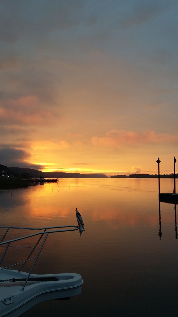
By pure luck, we found a great deal on an Endeavour 43
(designed by Robert Johnson) which we named Pearl Lee. You can start reading about our delivery trip from LaSalle, Ontario to Racine, WI here: Homecoming – Part 1. We have put a lot of work and money into her, but still feel she’s a great boat for us. For a list of some of what we’ve done getting her ready, look here: Moving Aboard or for general information about our equipment and living conditions aboard you can look here: Details, Details, Details

1000191
Kristi and Jake aboard Pearl Lee

As our date approached things went into high gear. We had a massive yard sale.  We moved aboard July 1, 2016 so that preparing Pearl Lee could become a full time job. We had a goodbye party at the dock to say “see you later” to friends and family from Northern Illinois and Southern Wisconsin many of whom had never been aboard a boat like Pearl Lee. Of course the hardest part was saying “see you later” to Jake, but he’s a fine young man and will find his way as we did.

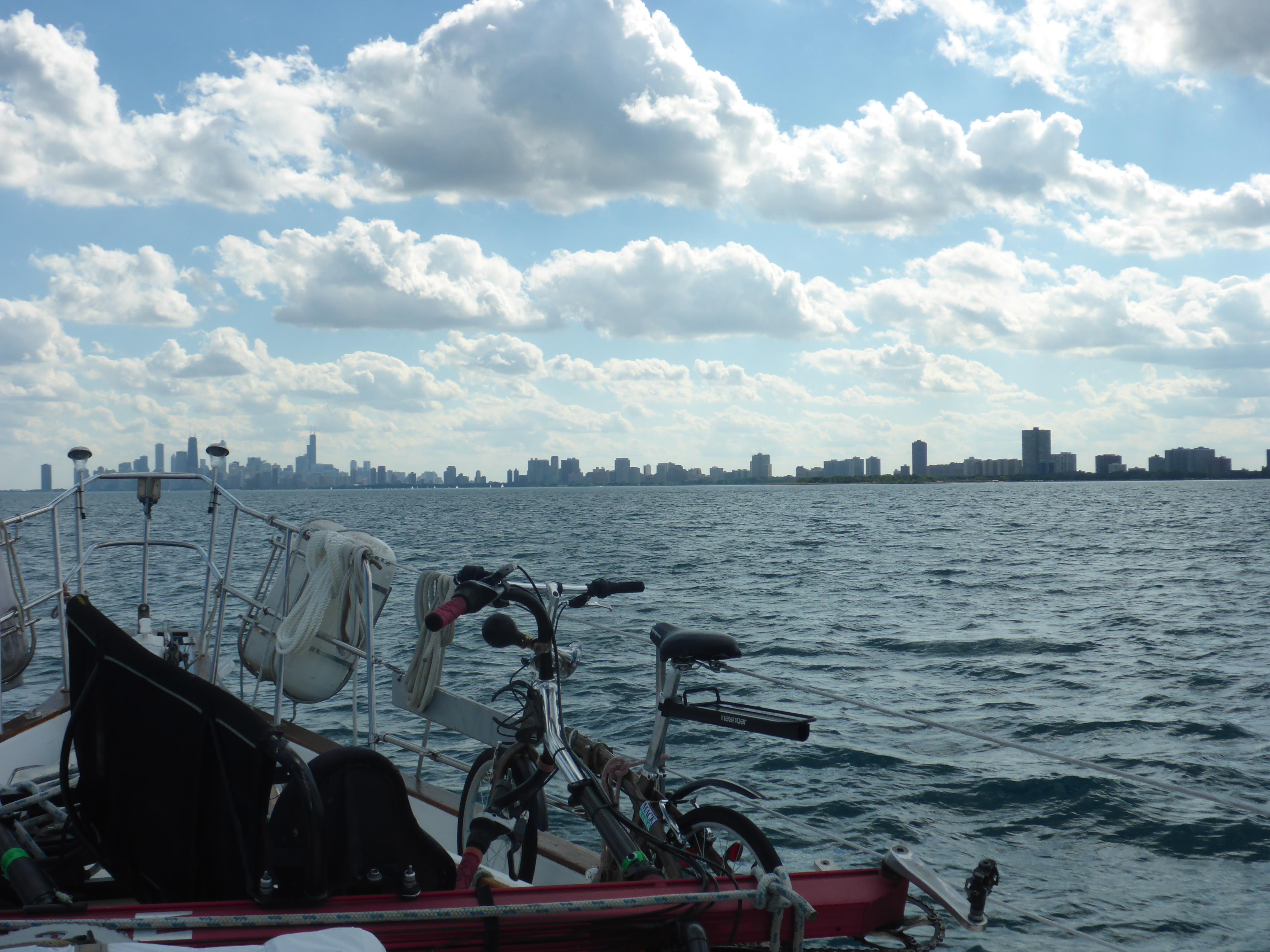
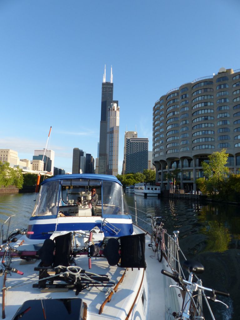
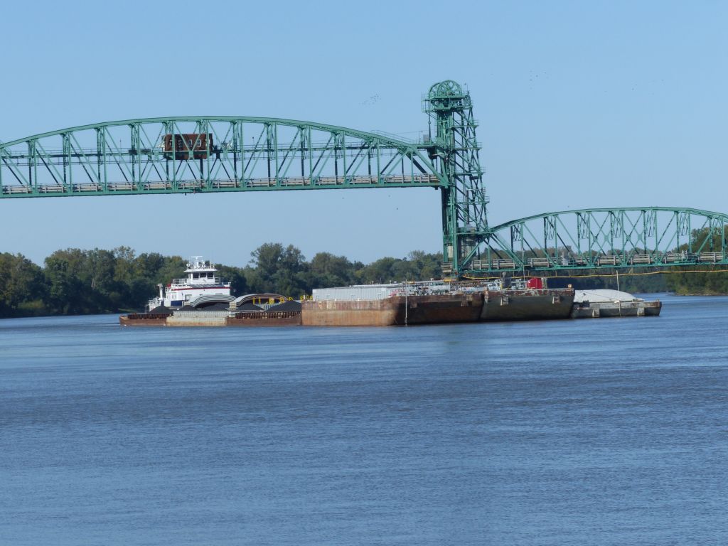
With lots of hugs, a few tears and a final send off from our friends at the marina we headed south to Chicago where we would enter the river system that would eventually take us to the Gulf of Mexico.

Stay tuned for the “rest of the story”. Next up: Our Route

Our River Route

Many have asked about our route, so here it is. We went down Lake Michigan to Chicago and then the rivers begin.

We go through the first of 21 locks to enter the Chicago River and Chicago Shipping and Sanitary Canal. The Army Corps of Engineers actually reversed the flow of the Chicago river through the use of this lock. This gave us the opportunity to take Pearl Lee right through the heart of downtown Chicago. What a sight seeing tour! We crossed under over 40 bridges in just 5 miles while boating down a concrete canyon of sky scrapers.

After 24 miles the CSSC joins the Cal-Sag Canal and from there it becomes the Des Plaines River and eventually the Illinois River. We’re not real clear on where all this happens because the charts (nautical maps) are not consistent in their naming. Total mileage to get to the Mississippi river at Grafton, IL is 327 miles. Grafton is just north of St. Louis.

After traveling 218 miles down the mighty Mississippi we make a sharp left at Cairo, IL (pronounced KAY-ro) to go up the Ohio River about 60 miles to the Cumberland River.

The Cumberland takes us 30 miles to the Barkley Lock and Dam where we briefly enter Lake Barkley before turning right into the land cut that takes us to Kentucky Lake, actually part of the Tennessee River. Alternatively, you can stay on the Ohio to get to Kentucky Lake directly. It’s a little shorter, but not as scenic and can be crowded.

We go up Kentucky Lake and the Tennessee River for 190 miles before turning onto the Tenn-Tom Waterway.

The Tenn-Tom Waterway was a larger project than the Panama Canal and links the Tennessee River with the Tombigbee/Black Warrior River. When we enter the Tenn-Tom we will be 414′ above sea level, so we’ll be locking down that distance over the next 411 miles.

Finally the Tombigbee/Black Warrior river will take us to the Gulf. Total distance is about 1100 miles.

This the route from Lake Michigan to the Gulf of Mexico

Previous: A New Beginning

Next: Racine to Chicago

Racine to Chicago

Off we went on a clear, sunny morning. Now that we were a motor boat, with our masts waiting at Pugh Marina, to be picked up by Albert Logistics we hoped for flat water, and got it… mostly.

Almost to Chicago
Chicago skyline

We found the rolling motion of Pearl Lee was much quicker without masts, so waves that normally would be almost unnoticed were getting our attention, but we made it with no drama. Still, we were happy to see the Chicago skyline coming into view.

Monroe Harbor
The view of Chicago from our mooring

Our original plan was to anchor for the night in an area Chicagoans call the Play Pen. Being a warm, sunny Saturday afternoon it was just too crowded and busy, so we decided to take a mooring at Monroe Harbor, and what a view we were treated to. Monroe does not have pennants (lines to attach to) on their mooring balls, so beware. We were forced to double a dock line and lasso the ball. That worked fine until time to leave. Our (new) dock line had become impossibly tangled on the mooring chain and we finally had to leave it behind. Luckily we had plenty more.

p1010438
Traveling through downtown Chicago

At first light, after our dock line wrestling match, we headed to our first lock. In order to continue onto the Chicago River we had to lock down a couple feet. We found we had been worried about nothing, but kept in mind we had much larger locks ahead, including one with a drop of 84 feet!

p1010504
Leaving the skyscrapers behind

Once through the lock we were treated to a trip few get to take. We cruised the Chicago River inside the concrete and steel canyon that is downtown Chicago. Because it was early Sunday morning we seemed to be the only boat on the river. If you can clear the lowest bridge on this route, 17 feet, it is definitely the one to take.  Just be aware there is one railroad bridge that is 11 feet closed, but they will open on demand. The alternative is the Cal-Sag channel, but you still have to get under a 19 foot bridge. For more pictures of Chicago by boat and more check out our gallery: Racine to Parts South Gallery

p1010551
Nature finds a way

As downtown Chicago gave way to a more industrial setting we encountered everything from factories to homeless camps, but even adjacent to piles of scrap nature supplies beauty for those who would look.

Electric Fish Barrier, Chicago Shipping and Sanitary Canal
p1010589
Small tows near Chicago

Continuing down the Chicago Shipping and Sanitation Canal (it’s best not to give too much thought to that last bit) we encountered the electric fish barrier. This is too keep Asian Carp, an invasive species, from entering the Great Lakes. It was also here that we began to encounter tows pushing barges. Yep, they’re called “tows” even though they push their barges. For the most part these were a non-issue for us. Just contact them by radio and they will tell you which side is safe to pass on. Interestingly, they still use the old “whistle system” that boats used before radios. So typically they might say, “I’ll see you on the one (whistle)”, meaning “put me on your port side”.

p1010572
Chicago Shipping and Sanitation Canal

Much of the canal is a true canal, meaning it looks like a trench filled with water. Because that’s what it is. No troubles though, it’s maintained at a minimum depth of nine feet for the tows. This is especially convenient if you happen to be on a sailboat that needs 5.5 feet of water.


Eventually the Chicago Shipping and Sanitation and the Cal-Sag

The junction of the Chicago Shipping and Cal-Sag Canals.

Canals meet up, with a nice marker to mark the spot, and tell up-bound vessels where to turn. From this point you’re on the Des Plaines or Illinois River, the charts seem to go back and forth for a while, so maybe it’s both.

Previous: A New Beginning

Next: Des Plaines River and Joliet

The Des Plaines River – Lockport Lock and Joliet

After the Chicago Sanitation and Shipping Canal came the Des Plaines River.

Inside the Lockport Lock
Floating bollard

On the way to our first overnight on the river (9/18) we traveled through our first “real” lock. The Lockport lock took us down 39 feet. We learned that locks aren’t so scary after all. Just pull up gently to the wall, put a looped line over one of the bollards (seen at left), and wait. The bollards actually float up, or in this instance down, with you. Keep a close eye on the bollard, in case it jams. Due to Pearl Lee’s shape tapering at both ends, we positioned ourselves fore and aft with boat hooks (telescoping poles used for pushing or pulling) to keep us parallel to the wall. Then, just wait until the doors on the other side open so you can leave.

Joliet wall

Our first stop was Joliet’s free town wall. Joliet is working hard to bring some vitality back to their riverfront, so they let boats tie up and even plug into electricity while visiting.  If you’re familiar with the area you might wonder why we’re pointed north. We always dock heading into the current for better control and slower speed relative to the dock. Unfortunately, right now there isn’t much there but a city park. We actually had some business with the Post Office, and since it was Sunday, we spent an extra night here.  Luckily for us, our friend Mike offered to drive us to pick up a few needed items, and to the all important Post Office.

Beautiful old home in Joliet

The extra night gave us time to do a little exploring by bicycle. We were bicyclists before starting this new life, so it seems pretty natural to us. The area we were in is still a little sketchy, but is well patrolled, and offers some beautiful old architecture.

Even with the patrols we were advised not to leave our boat alone at night, so once our business was done we headed on down the river.

Previous: Racine to Chicago

Next: Joliet to Buffalo Rock

Joliet to Ottawa (Buffalo Rock State Park)

Illinois River sunrise

We left Joliet very early (9/20) to join some of our new boating friends (we met right here in Joliet) locking through at Brandon Road. This would be our first of three locks today for a total of 80 feet. Locks are a major part of life traveling on the rivers.

I should mention that commercial shipping has priority in the locks, and it might take a single tow with barges hours to get through. So when someone called ahead, and the lockmaster said it was clear, we hurried to get there.

Abandoned river barge

As we traveled down the river there were places littered with derelict barges. Apparently they’re not worth dismantling for scrap!

Duck blind

On the other hand, we saw some pretty creative duck blinds in the shallower areas. Don’t worry, with our 5.5′ draft, they didn’t pose any hazards to us. We’d be hard aground long before we got to a duck blind.

Cutting a path through the algae

We even motored through a beautiful green carpet over the still water for a few miles. I was a little concerned about clogs in our cooling intake, but we didn’t pick any of it up. Sorry, I don’t think the camera did it justice.

Loading coal barges

We wondered a bit about what was in all the barges we saw, but soon it became obvious. We were entering coal country, where the rivers are the most economical way to ship this commodity.

Our first Bald Eagle sighting

We often saw a mix of industry and nature that is hard to describe. Interspersed with factories, mines and grain elevators we forests, rock formations and wild life. I have to say, though we eventually saw hundreds of bald eagles on this trip, it never grew old. This is our earliest sighting.

Anchored at Buffalo Rock State Park

At last the end of the day came as we slowly pulled behind Sheehan Island and anchored just off Buffalo Rock State Park near Ottawa, IL. This was particularly exciting for us, because after having suffered a few less than stellar anchoring episodes, this time our new Rocna 25kg anchor stuck the landing. Notice the triumphant look from Kristi! We had a nice, quiet evening with no one else around for miles.

Previous: Joliet to Ottowa

Next: Ottawa to Illinois Valley Yacht Club


Ottawa to Illinois Valley Yacht Club

Red sky in morning…

9/21/2016

We both woke early and were greeted with the kind of beauty that fuels dreams like ours. We were so awestruck that we didn’t even think “red sky in morning, sailor take warning”. We were about to have a very interesting day.

Although we planned to stop for a bit at Starved Rock State Park  the weather, and shallow water, wasn’t cooperating, so we pressed on.

Storms ahead

As a storm approached, we decided to anchor early for the night and headed behind a small island. Instead, we ran aground. It was then that we realized to get behind a towhead (small island) we needed to go far down river and then come up behind it. Too late now!

With an 18 ton boat being pushed aground by current and wind, our 85 hp was failing at backing us off. We began discussing options to get free, when we felt mother nature give Pearl Lee a nudge… Then another! Full power in reverse got us back out to the channel, and we decided to continue through the storm.

After the storms

We found out that while waves weren’t a problem for us on protected river waters, blinding rain was. Navigating a winding river shared with tows and barges while you can barely see past your own bow is not something we’d like to repeat.

The rain subsided, the sun came out, and it was a beautiful day again. We tried to get fuel, but were thwarted by a faulty pump one place and low water at another. We still had about 75 gallons, we just don’t like to go below half unless we have to, for just this type of situation.

One of many bridges we passed under

We continued on to Illinois Valley Yacht Club (IVY) on Lake Peoria, which is really just a very wide portion of the river. Although IVY was a little on the shallow side for us, we got excellent instructions on how to approach and everyone was wonderful. We managed to spin 14′ wide Pearl Lee into a 15′ wide slip without hitting anything, and spent a quiet evening here. Other yachtsmen brought us fresh tomatoes and our new friend Phyllis from Avocet even drove Kristi into town.


Previous: Joliet to Ottawa

Next: Peoria

Peoria!

9/22-23/2016

We woke up to the news that the wicket damn just down stream was about to be opened. With our 5.5′ draft, that meant we had to leave soon, or it might be a while before we could.

Free town docks in Peoria

We had planned a stop at Peoria’s town docks, but some of the locals were saying there wasn’t room for a boat our size. After consulting Active Captain data and reading a very detailed review, we used Google Earth to see that the docks were exactly as described. You gotta love technology, at least when it works!

Just off the dock

Using dock lines to give fine control, we backed Pearl Lee out of the small slip and fueled up at the fuel dock.  Then, using a combination of bow thruster* and prop walk** we pivoted out of the tight marina as if we knew what we were doing.

With the current pushing us along, and no lock to go through, it only took about an hour to get to Peoria. As we tied up at the excellent, but seagull poo encrusted dock, a fellow approached down the dock. It turned out that Mike and his wife Karen, who was just behind, were out for a walk and saw us pass by.

Pearl Lee at the free dock in Peoria

They came down to hear our story. After a little conversation they offered to take us to lunch, and since they weren’t giving off any serial killer vibes we took them up on it. We had a nice lunch with wonderful conversation, followed a short car tour of downtown Peoria. Mike was justifiably proud of the strides his city has made in recent years.

The biggest truck in the world!
Trying out the heavy equipment

Peoria has a very vibrant riverfront district with more shops, bars and restaurants than we could possibly visit. Since Peoria is Caterpillar world headquarters there is also a large Caterpillar museum. If you’re in the area, you won’t regret spending some time at this amazing museum. It starts with a short film in a theater, but the theater is built in the bed of the worlds largest truck! These trucks are shipped to mining sites as a “kit” and then assembled on site. There are all kinds of Caterpillar equipment to climb on, simulators to try out, and the entire place is staffed by proud Caterpillar retirees.

The town docks are in the heart of the riverfront district, and Walmart is just a short dinghy ride across the river. There is plenty to do and see within a short walk from the docks. What more could a cruising boater want? The only real downside, besides the seagull guano, is train and traffic noise, but being city folks we could deal with it. We stayed an extra day, and never saw another cruising boat stop. It’s a pity, they don’t know what they’re missing.

Free concert from Pearl Lee’s deck

We decided to try Kellaher’s Irish Pub for dinner, and it was incredible. Returning from dinner we found a free concert was being held in the square just off Pearl Lee’s stern. An excellent Zac Brown tribute band was followed by a great funk band. What a night, watching a concert from the comfort of Pearl Lee’s aft deck.

Night time tow traffic

The tows run all night long. Moving slow they generally don’t create a huge wake. Sorry, I don’t know why a boat that pushes its load is called a “tow”, just don’t call them tugboats.

The following day, we mostly… uh… just recovered. Resting up from a late night, and for the journey ahead.

  •  * Bow thruster: a sideways propeller for pushing the bow around
  • ** Prop Walk:  the tendency for an inboard power boat’s propeller to “walk” sideways

Previous: Illinois Valley Yacht Club

Next: Peoria to Beardstown

Peoria to Beardstown

Kristi is bundled up

9/24/16

We left Peoria early in the morning with a bit of night chill still in the air. We weren’t quite on “island time” yet and we felt a bit behind schedule, even though we didn’t have a schedule.

The morning was a bit foggy due to the low temperature, but not dangerously so. Just enough to add some ambiance (say with a French accent).

Early morning fog

With Peoria’s wicket dam open, we could go right through without needing the lock. With the next lock 80+ miles away we were hoping for a big day. Off we went, moving with the Illinois river. It was a strange feeling taking Pearl Lee directly over a dam. After all, this is normally something we avoid at all costs!

Abandoned barge loading facility

Soon the sun broke through and began to heat up the day. Among the natural scenery we occasionally found the remnants of human intervention. We like pondering their history. How long were they in use? How long ago? How long before nature reclaims what is hers? Moving slowly along the rivers gives us plenty of time to think.

The Love Shack?

In some cases the river has moved, leaving loading facilities high and dry. Others may still be used occasionally as fishing shacks. We were putting in some miles, so we had to wonder as we continued to move south. This one has a “tin roof, rusted”, maybe it’s the B-52’s Love Shack.

One of many Monarch butterflies

As we traveled along we got a nice surprise. Monarch butterflies! Hundreds of them over the next few days. Back in Racine, Wisconsin, Kristi raised a couple Monarchs from eggs. They escaped the chrysalis and were released shortly before our departure. Now we found ourselves on their migratory route! Unfortunately, none were patient enough to pose for a good picture.

Tows create a lot of turbulence

We continued to see more and bigger tows. These boats have thousands of horsepower and huge props. So we have to be careful passing them. They leave turbulence in the otherwise smooth water hundreds of yards behind them. It can make steering exciting, but once you learn to anticipate it’s twists and turns it’s not a problem.

Grape Island anchorage with Somewhere In Time

After traveling almost 80 miles, it was time to look for a resting spot. We were running low on daylight and had another lock a few miles ahead. So just south of Beardstown we decided to duck behind Grape Island, but were having trouble finding deep enough water. Our new friends aboard Somewhere In Time radioed us with directions to their deep anchorage behind Bar Island, just a half mile down river. People helping people is what this is all about.


Previous: Peoria

Next: Hardin


Beardstown to Hardin, IL

9/25/2016

We rose early to get under way again for a planned 60 miles or so to Hardin, IL. We had heard of a great restaurant with some old barges to tie up to, so that was our destination. We hoisted anchor early in the morning with just a bit of fog, and we were on our way again.

It was another beautiful day, and with this guy greeting us, it was going to be a great day. Pearl Lee was running great and we were passing Pearl, IL today. Yes, it was a good day!


We encountered our first Army Corps of Engineers dredge. It’s a big operation keeping the river channels open for commercial traffic that’s even deeper  than our 5.5′ draft. We thanked them for their work as we passed by.


We had the river mostly to ourselves after passing the dredge. Once again, there are interesting things to see when you’re watching from a slow boat traveling the river.


We found houses on stilts, nice places to watch the river go by, and a decaying riverboat, no doubt someone’s broken dream.


And of course we passed Pearl, IL. All we could see was the Pearl rail road bridge, but that was enough for a small salute.


We reached our goal of Hardin and Mel’s Illinois Riverdock Restaurant by mid afternoon. A friendly guy in a pontoon boat was happy to move down the dock to give us room. He later confessed he just wanted to see how we were going to dock such a big boat.

There’s not much else in Hardin, but we stayed a couple days to do some minor boat work. Mel’s serves down-home food and they’re very friendly. In fact, the whole town seemed friendly.

Again, you’ll notice that Pearl Lee is facing up river. In cases like this we have to go past our destination, turn around and then come into the dock going up river.

Previous: Beardstown

Next: Grafton

Hardin to Grafton, IL

Muddy water makes a good silhouette

With only about 20 miles to go to Grafton we weren’t in a big hurry to leave (9/27). Grafton was a necessary stop because it’s the start of the Mississippi River portion of our trip. On the Mississippi good places to stop are widely spaced, and we had our strategy set. It was also a good place to meet up with Kristi’s sister and brother-in-law.

Tows are getting larger

More tows were encountered, but of course just a taste of what was to come. If we’re near a curve or narrow portion of the river we radio the tows and ask what side they’d like us on. The tow drivers answer with “one whistle” if we’re to pass with them on our port (left) or “two whistle” if they’d like us to pass them on our starboard (right).

Grafton, IL
Pearl Lee at Grafton Harbor

Billed as the “Key West of the Midwest” we had high hopes for the Grafton Harbor Marina. We were there in their off season, so… not so much. We heard from others that it was pretty wild just the week before. Maybe that’s a good thing.

Grafton Harbor has nice docks and are relatively inexpensive, which is good. They even gave us a “buy 3 nights, get two free” deal. Many people making the trip down the rivers stop for a while, as we did, to rest up before the Mississippi.

The Ruebel Hotel

Grafton is an interesting little town with a rich river history. The Ruebel Hotel in particular intrigued us with stories of watermen, hauntings, and a fire where the townspeople saved the imported bar and backbar. They have great pizza too, always a plus.

The Loading Dock

We also visited the Loading Dock a short bike ride away. It’s billed as the only waterfront bar in the St. Louis area. It’s a very eclectic place, and anyplace that pays homage to the bicycle is fine with us.

We didn’t see a lot of the famous jumping Asian Carp on the rivers. They’re an invasive species that are often startled by boat motors and jump high out of the water. I guess old four cylinder diesels don’t scare them. However, Kristi was startled by sudden splashing next to the dock in the dark. By the time I went to investigate, we had more light and the source was obvious. Feeding Asian Carp were startled at her approach.

Grafton Sunset

We enjoyed our long stay at Grafton, but eventually it was time to move on. After all, it was October and the weather would start getting cold here soon.

Previous: Hardin

Next: Hoppies (Kimmswick, MO)