Kimmswick, MO to Grays Point, MO

Mississippi River sunrise

10/4/2016

We left Hoppies early, with some apprehension after our crash landing the day before due to the swift current. Everything went smoothly, Pearl Lee driving hard up current as we crabbed to mid-river to miss wing dams just down river from us. A quick 130 degree turn and we were motoring along with a 5 – 7mph boost from the current.

We were bound for an anchorage near a lock just up the Kaskaskia River, but plans can change.

Being on the mighty Mississippi makes steering our sailboat, uh, interesting. Of course we had lots of tow and barge traffic to contend with. Even Fern, at Hoppie’s, says she can’t understand them. Here’s my version, just to give you an idea.

More coal loading

It’s OK though, we can always make out “pass me on the one” (your port) or “pass me on the two” (your starboard), which is what we really need to know. You might notice I’m also pretty busy with the steering wheel due to the many swirling currents we encounter.

A freight train heading up river

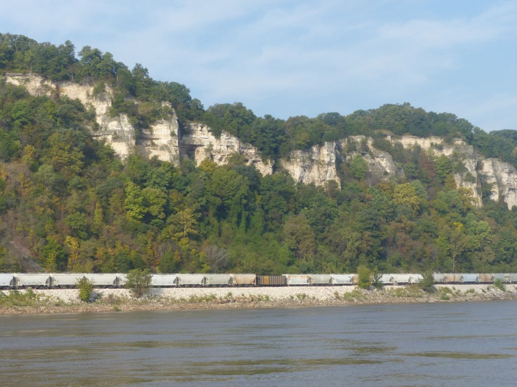
Although we were getting into a very rural part of the country we still saw plenty of signs of industry. A lot of coal comes from here, or passes through.

Coal and limestone trains run along the river’s edge in order to avoid going up and down the valley.

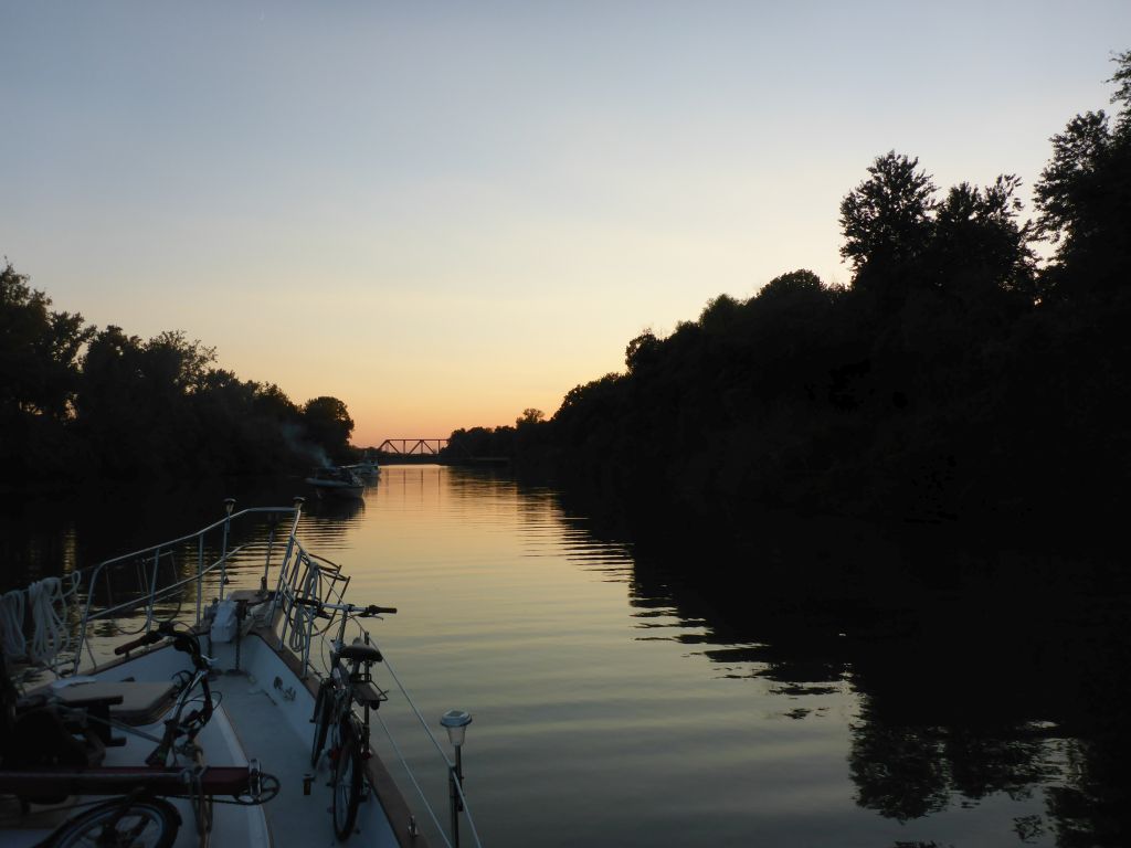
Before we knew it we were approaching our planned anchorage in the Kaskaskia River. Deciding it was too early to stop for the night we pressed on.

River navigation tools

We identified a couple anchorages farther along that we thought we might take. Speaking of planning our stops, we got great information from Mark and Diana Doyle’s Managing the Waterway Guide and also Skipper Bob’s guide books. Here you see Kristi’s three favorite navigation tools. Meanwhile I was arguing with the river about which one of us (me or the river) was actually driving the boat.

Little River Diversion

With the fast current pushing us along, and no locks to wait for, we kept getting to our planned anchorages too early. We finally decided that we could make it to Little River Diversion near Grays Point, Missouri. A run for the day of 110 miles! We couldn’t believe it, but we had just done a normal two day run in one.

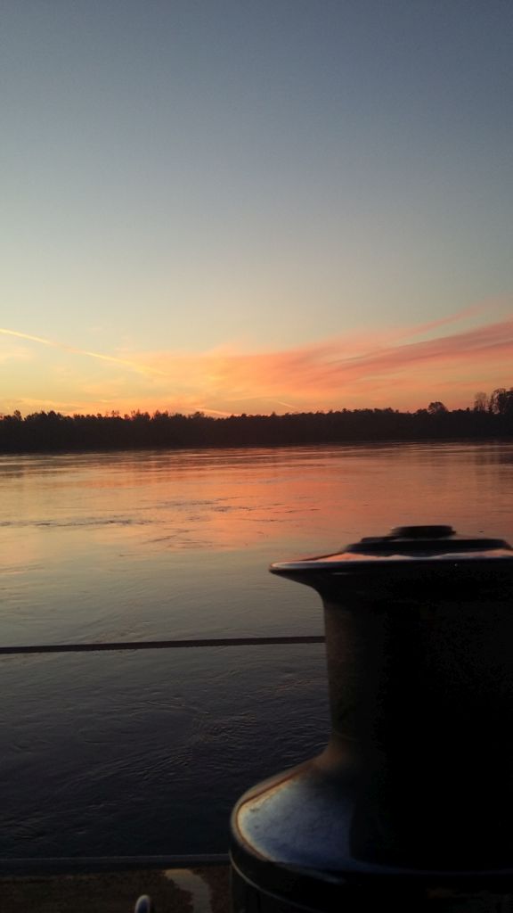
With the sun setting we crabbed our way into the diversion at about a 45 degree angle, fighting the current while inching over. It seemed a little scary but was actually pretty easy. Once we were in we were treated to perfectly calm water and a beautiful spot to spend the night.

Previous: Hoppies (Kimmswick)

Next: Metropolis


Grays Point, MO to Metropolis, IL

10/5/2016

Mississippi River mud

Another early morning departure. We had anchored, once again, in a muddy river bottom, so Kristi had a mess to clean up. The hose you see is our “raw water washdown”. It pumps water from around us so we don’t use our good water for things like anchor and deck rinsing.

Once we headed out into the strong Mississippi current we would be committed. There could be no stopping, so we made a Security call on the VHF as we left Little River Diversion to warn any boating traffic on the Mississippi that we were about to appear. No problem, since it turned out no one else was around, and we made our way downstream.

Seeing Bald Eagles never gets old
Bald Eagles were becoming common

By now we were seeing eagles all day, but each one was still a thrill. We love seeing these majestic creatures in their natural habitat.  “I guess he’d be a poorer man if he never saw an eagle fly.” – John Denver.

Still on the Big Muddy for a bit, Tom continued to argue with the river over who was steering the boat. So much so that we started to think something was wrong with our steering, or Tom.

With fast current comes high turbulence and steering was a full time job. While countering the swirling water, we also had to watch out for debris, sometimes whole trees; and deadheads, almost invisible floating just under the water. Channel markers get moved out of position and even do a magical disappearing and reappearing act!

Cruising at 12 knots

The upside to all that current is speed! We were doing 218 miles of Mississippi River in just two half days and a full day. Notice the Speed Over Ground (SOG) at 12kts (13.8mph)!

Around noon we made a sharp left turn onto the Ohio River. Suddenly steering was easy again, and our speed dropped to  6-7kts due to a gentle current flowing against us.

We decided to stop at Metropolis. We read about a good anchorage between the casino and bridge, near an old boat launch. Perfect, we thought, we can land the dinghy and go see the big Superman!

Metropolis, IL sunset

What we found was a homeless camp next to the ramp, so we decided  not to leave either boat unattended. After anchoring bow and stern, to insure that we wouldn’t swing into shore or out into the river we were treated to another beautiful sunset. With the mighty Mississippi behind us, we were looking forward to some easy cruising and beautiful scenery ahead.

Previous: Grays Point

Next: Cumberland River Junction


Metropolis, IL to Cumberland River Junction

Interesting storage

At first light we were heading farther up the Ohio River, bound for the Cumberland River. The current was gentle and we were making almost 6 kts speed over ground. Did you ever see something and just know that it was designed by a man? We had one of those moments not far from Metropolis.

Salvaging a river boat

The day was fairly uneventful, other than meeting a few tows. The Ohio is wide, with little current though, so drama was at a minimum. One of the more unusual sights was this old river boat, being torn apart for salvage.

We stopped for the night at a place called Cumberland Island Towhead, just half a mile from where the Ohio and Cumberland rivers meet. In the still water we saw hundreds of fish (Asian Carp) feeding at the surface.

Fishing to kill time

Kristi did some beer drinking… uh fishing. She caught and released a couple small catfish. We generally just relaxed and watched the sunset.  The perfect end to a relaxing day.

Ohio River sunset

Sitting well out of the channel in a beautiful protected anchorage. Watching the setting sun as the tows go by. This is why we made this trip.

Previous: Metropolis

Next: Hardin, KY

Cumberland River Junction to Hardin, KY

10/7/2016

Early morning on the Cumberland River

Another early morning start, heading up the Cumberland River. The Cumberland is a gentle, winding and very scenic river. We definitely recommend this route for the scenery.

Charts aren’t always accurate


Our modern GPS’s are extremely accurate, but we’re still often using chart (map) data created by men wearing buckskins while paddling canoes. Watch where you’re going and verify visually what you see on the screen. Here the chart says we’re on land, but we weren’t. Had we followed the chart, we may have been.

Cumberland River beauty
The magical Cumberland River


Every bend in the river revealed more beauty. What a place! We just cruised along and took it all in. There were interesting bluffs and rock formations everywhere, mirrored by the calm water. It was fun to watch our ripples as we motored along as if we were the only people on the river.


Loading rocks

There is still barge traffic here, but we didn’t see any moving all day. We did come across some barges being loaded. With some rocks the size of washing machines, and not all of them landing in the barge, we gave them a respectfully wide berth.


Of course we were only doing enough of the Cumberland to get us to Lake Barkley and Kentucky Lake, so our time on the Cumberland was short.

Barkley Lock

Before we knew it we were approaching the Barkley Lock and Dam. A somewhat new experience for us, we’d be going UP this time. 57 feet of up! Here’s Kristi using the boat hook to keep our bow off the wall. I’m doing the same at the stern. Powerboats with straighter sides seem to lie against the wall without as much prodding.

Very nice homes on Lake Barkley

After our ride up, we found ourselves on Lake Barkley. We tried to anchor in a little cove, but after three tries we gave up. Locals later told us that particular cove is a bit of mud over solid shale. No wonder we were dragging. Frustrated, we took the cut over to Kentucky Lake and headed for Kenlake Marina.

Kenlake was very accommodating, even charging us less when they found out we wouldn’t need electricity. At 75 cents a foot per night, Kristi made a command decision and booked us for two nights.

Previous: Cumberland River Junction

Next: Kentucky Lake

Kentucky Lake Exploring

10/9/2016

Kentucky Lake

After a little rest we decided to play in Kentucky Lake just a little bit. Kentucky Lake was formed when the Tennessee Valley Authority dammed the Tennessee River, flooding a 250 square mile area. This results in a “lake” with more little coves to explore than you can count.

Island cemetary, Kentucky Lake

This is a truly beautiful area. The TVA relocated graves that were going to be underwater. This bit of cemetery, once a hilltop, is now an island, accessible only by boat. Since they would remain above water, they were left here. What a beautiful spot to rest.

bryozoans

We spent the day exploring, and learning. We weren’t sure what this was, but we saw several. We later found it was bryozoans which filter the water for food, keeping it nice and clear. Cool, huh?

Beaver hut

With the water at “winter pool” level, a lot of rocky shoreline was exposed. This normally submerged beaver hut was exposed and abandoned.

We also found lots of tracks in the mud, but being city slickers, we weren’t sure what made them. Probably raccoons, maybe beavers.

Eastern Comma butterfly

Of course every kind of wildlife abounds here, especially in the “Land Between the Lakes“, a 170,000 acre recreation area separating Kentucky Lake and Lake Barkley. We’re always on the lookout for butterflies and spotted a few Eastern Commas like this one. The coloring and wing shape help camouflage them among fall leaves. This one may not have gotten that memo.

Kristi with Pearl Lee in the distance

We can only imagine what this place looks like when fall colors are unleashed on the hillsides. We had a fantastic day exploring, and could easily spend a long time here without tiring of the scenery and exploration opportunities. We spent a quiet night at anchor in a little cove before moving on once again.


Previous: Hardin, KY

Next: Iuka, MS


Kentucky Lake to Iuka, MS

10/10-12/2016

Lake fog

We left early in the morning with Deep Purple’s Smoke on the Water in our heads. We tried to catch the little swirling vortexes on video but were unsuccessful.

More Kentucky Lake beauty

Fall was in the air, so it was time to head south again. Of course Kentucky Lake gave us plenty to see on our way. The landscape here is dominated by forests and stark cliffs.

Former Tennessee River bridge

Every now and then you get a reminder that this is a flooded river valley. Sometimes it’s just an old road that goes into the water, often used for boat launching nowadays. Other times it’s a bridge to nowhere, that once spanned the river.

Grain loading dock in Kentucky Lake

Then there are dramatic reminders like this old grain loading dock. Once on the banks of the Tennessee River, it now sits flooded and surrounded by water. No one seems to know why this structure was left when the TVA tore down the other buildings before flooding the valley.

Camper boat

As we cruised along we saw all sorts of boats, and we often wondered how far they were going. Many were doing the Great Loop of the eastern US. We think this guy might have the perfect boat for cruising the river system. Shallow draft, low cost and all the comforts of home.

We saw catfish jumping (or maybe Asian carp again) along the way.


Tennessee River sunset

Anchoring in a quiet cove at night and then pushing on the next day.

The Tennessee River is truly God’s country with breathtaking scenery around every bend.

A tough of fall color on the Tennessee River

We were starting to see some fall colors, just a hint of what was to come. Of course that also meant cold weather was coming. With no real heater on the boat we had to keep moving.

Awe inspiring Bald Eagles

We were still seeing eagles as this is their winter nesting area. Unlike us, they don’t mind the cold, but they do need open water to fish in. This pair of males seemed to be just hanging out together.

Glassy water on the Tennessee River

Mornings often greeted us with still water and brisk temperatures. You just can’t get tired of scenes like this. The only ripple on the water was made by Pearl Lee’s passing.

Shore erosion can be a real problem

Of course we also saw where men encroach, but nature always wins. Someone has a real problem on their hands here.

We pressed on towards Pickwick Lake. This is another TVA project, smaller at 67 square miles, but deeper than Kentucky Lake. Pickwick Lake’s waters are often crystal clear.

Instant karma

At the Pickwick Lock we got a nice demonstration of discourteous boating, as a powerboat jumped the line to get ahead of us. We were then treated to a demonstration of how NOT to lock through by the same boater. During his, uh “maneuvers” we heard a few loud crunches. No one was hurt though.

Pearl Lee with one of her family

We made it to Aqua Yacht Harbor Marina just as the sun was setting, directly in our eyes. For some reason they booked us into a covered slip with inadequate depth due to an underwater structure. We ended up docked next to another Endeavour, how cool is that? To their credit, when I mentioned the issue, they gave us a free night. Nice folks.


Previous: Kentucky Lake

Next: Shiloh


Shiloh!

Cannons mark battle lines at Shiloh

(10/13/16)

While staying at Aqua Yacht Harbor we decided to take a short trip to Shiloh National Military Park.

If you go, we highly recommend the CD audio tour. It lets you see the various battle fields in chronological order while explaining the what’s and why’s.

This old house still bears some bullet holes

Although the orchard is no longer an orchard and other vegetation has changed you get a clear idea of what went on.

Particularly interesting to us was the naval bombardment from the river, which we had just come down in Pearl Lee.

Silent cannons

History comes alive in places like this. Although the cannons don’t thunder, and men don’t scream, the ancient echoes still seem to linger. Seeing places that you’ve only read about gives a much greater sense of what transpired here than any book or movie ever could.

Shiloh National Cemetary

The Shiloh National Cemetery is here as well. It’s good to go to places like this and reflect on our history and what so many of us owe to so few. This is hallowed ground and hopefully will be treated as such for generations to come.

Previous: Iuka, MS

Next: Lake Pickwick

Iuka, MS and Lake Pickwick

(10/13-17/2016)

We had a lot of fun meeting people and generally hanging out at Aqua Yacht Harbor.  Since they have loaner vehicles we got a chance to see the surrounding area, including Shiloh National Military Park. Of course we also found some other fun  and mischief.

We found a shark, even though we were still on the rivers. After looking around we decided this wasn’t the place we were looking for.

On down the road we found a wonderful little place, apparently owned by Big Foot(or is it Sasquatch?), but we weren’t sure what he was doing. We didn’t ask. The food and service were great though and the place had a very woodsy feel.  It’s on Highway 57 across the dam. You can’t miss it, just look for Big Foot.


Aboard Terry and Marlane’s motor yacht

AssWhaffle Yacht Club members Terry and Marlane showed us their beautiful motor yacht, treated us like family and gave us a boat tour of the area. This lead to a little detour for Pearl Lee, as you’ll see.

Having a good time with Wayne and Beth

Wayne and Beth just “wanted to see what the sea gypsies were up to”. That chance encounter became a weekend of fun, laughter and several docktails. The boating community is full of wonderful people.

Pickwick Lake waterfall

We really enjoyed our few days here, but eventually it was time to move on. However we had one more thing to do. A slight detour and one more night in the area was in order because Terry and Marlane showed us a hidden gem of an anchorage on Pickwick Lake.

A tiny cove with a waterfall. Completely protected, and even at winter pool it was 14 feet or so deep! Here’s a 360 degree video just after we anchored.

The view from atop the waterfall

As you can see, being late in the season, we were the only boat here. Terry said it fills up on summer weekends though. This was such a beautiful spot we really hated to leave! There was even a steep trail to the top  the falls.

Full moon, waterfall, still water perfection

The night was lit up by a full moon. How perfect is that? It was like we had a full day of Zen.  We had a brief visit from a small power boat and a visit from a jet skier who just wanted a few minutes watching the water. What a place! Thanks Terry and Marlane, this was an awesome gift.

I’ll close with a video we shot from the base of the water fall.

Previous: Shiloh

Next: Tupelo, MS

Pickwick Lake to Tupelo, MS

(10/18-19/2016)

Pearl Lee at the waterfall
Fall colors on Lake Pickwick

After our refreshing stay in the waterfall cove we bid Pickwick Lake a fond farewell. We joined the Tennessee-Tombigbee Waterway (Tenn-Tom) and headed south with fall colors starting to come out. The Tenn-Tom was a huge public works program by the Tennessee Valley Authority. As the name implies the Tenn-Tom joins the Tennessee and Tombigbee rivers. Completed in 1984, more earth had to be moved than for the Panama Canal! The waterway has a minimum width of 300 feet and minimum depth of 9 feet for it’s 234 mile length. This greatly shortens travel for commercial shipping going to places like Nashville. It’s also more accommodating to recreational boating than the lower Mississippi.

The Divide Canal

Shortly after leaving Pickwick Lake we had to travel through the Divide Canal. This 25 mile section of the Tenn-Tom is 100% man-made canal. There is no stopping allowed in this section, so be prepared. Yes, it’s boring, but it’s also necessary.

Because we wanted some time to explore Tupelo, we anchored for the night in Natchez Trace Recreation Area. This way we could get to the Tupelo area early enough for some land fun.

John Rankin Lock

On the way to Tupelo, we had to go through the very impressive John Rankin Lock, taking us down 31′. Those are the entrance doors towering above us just before we moved out on the other side.

We docked for the night at Midway Marina in Fulton, MS intent on getting to Tupelo. They have loaner cars, so no problem right?

Elvis Presley’s boyhood home
Elvis Presley grew up in this tiny house

When we got in the car we found a note that said the car is to stay within Fulton city limits. Being pirates, we found a way and got to have a brief visit at Elvis Presley’s birthplace.

It was very illustrative of just how poor his family was during his formative years. There was also lots of Elvis memorabilia from every stage of his career, but we found his home to be the most interesting.

Only two rooms in total, the other being a simple bedroom. We didn’t get to see Paul Thorn though, so I was a little disappointed.

Previous: Lake Pickwick

Next: Demopolis, AL

Tupelo, MS to Demopolis, AL

(10/20-22/2016)

Anchored just off Blue Bluff Campground

With fine weather we left Midway Marina in Fulton, MS and pushed on south.  We were starting to feel some urgency. In our minds, Mobile, AL was our river destination. In Mobile we would start a new trip… with masts… as a sailboat… in saltwater!

It was an uneventful day and we spent the night anchored off the Blue Bluff Campground near Aberdeen, MS. We were able to take a nice walk through the campground and chatted with other boaters as well as campers.

Sunset near Aberdeen, MS

We had another beautiful sunset, and slept to the sounds of owls and coyotes in the distance.

In the morning we were eager to move along and got an early start.

Tom Bevill Dam

We had a nice view of the Tom Bevill dam from inside the lock. Otherwise it was another peaceful day of churning our way down the Tombigbee.

We spent the night anchored in an ox bow off the Tombigbee.

Anchored on the Tombigbee River

The next morning we were met with very low river fog. It was interesting to watch the tiny vortexes form and break apart as we headed out for the day.

White cliffs in Alabama

Of course the sun quickly took over and the wisps of fog were gone. It was a beautiful day to see the white cliffs near Epes, AL. We weren’t sure what to expect, but we weren’t disappointed.

If you click to see this picture enlarged, you can see a couple fishermen to give you a sense of the scale of these majestic white cliffs.

At the white cliffs. What is it?

The cliffs have some mysterious features, and we’d love to learn the full history. They continue for five miles or so. What a beautiful area to cruise through in a slow boat!

The white cliffs stretch on for miles

You can see the fall colors just starting to pop out. This far south I don’t know if they get much more, but it seemed about perfect to us.

We kept humming along, making miles before nightfall. We had a very tricky refueling stop due to a large tug blocking most of a narrow entrance, but we made a plan and the plan worked. We docked for the night at Demopolis Yacht Basin where cruising boaters have a nightly meeting to discuss the state of the river ahead. This is the last marina before Mobile, AL 200+ miles away.

Previous: Tupelo, MS

Next: Mobile, AL